

About ChintaPhu Trek
ChintaPhu trek is not an untrodden route but very few people have set foot on this route. Many people know about Chintafu. Local guides refer to Chinta Phu as Sandak Phu’s sister. The height of Chintapur is 33 meters< less than <Sandakpur. The height of Chintafu is 3633 meters i.e. 11929 feet. Chintafu includes not only Chintafu to Kangchenjunga, but also Everest, Makalu and Lothse in clear October skies. This view is also not available from Sandakphu.
Chinta Phu is the best option for those who want to do short and short time trekking as well as sightseeing. Low cost, less hassle, just three days off with Saturday and Sunday. Tracking is only up-down (4+4=8) of 8 km. Age will not be a barrier.
Trek summary
- Elevation: 11929 feet
- Basecamp: Mamazua
Best time to visit
ChintaPhu or Chintapur trek offers a variety of floral displays from late March to April, including rhododendrons in abundance. Forests, valleys, natural water bodies, waterfalls, if you are lucky you will get to see Kangchenjunga and summit Everest when there is no snow and clouds.
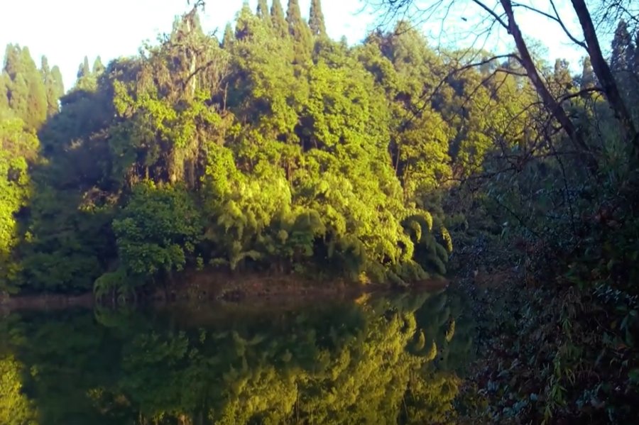
The way from Siliguri to Darjeeling via Mirik is thronged by tourists who do not stop and shop at Pashupatinagar on the Nepal border. From Pashupatinagar, you’ll have to drive a Nepali car for four hours to Mamjua in Ilam district. On the way you will come across a huge water body called Maipokhri which is completely covered with vegetation. This water source is very sacred to the Nepalese. It would be great to travel around. But it is better to see the return day. Departure day will not be cold. Stay at Kamal Dajur Homestay in Mamazua. There are also great waterfalls in Mamazua. You will see that later.
After spending 1 night, the next morning leave for Garulivanj, 12 km away by Land Rover. The beauty of the path is extraordinary. And after spending some time beside a small holy pond, you will reach the small Chitra village of Garolivanj. The accommodation here is very basic but the surroundings are spectacular. A road leads to Chinta Phu on the left and Sandak Phu on the right. After tea-breakfast start walking towards Chinta Phu with guide porter. If you need or want to stay overnight then you must take a sleeping bag with you. On this way you will find extraordinary floral beauty and another small pond.
After spending some time at Chintapho without people and if there are no clouds, you can see Everest, Kangchenjunga and come up to Garulivanje. And if you want to watch the sunrise and snow-capped peaks in the morning sky, spend the second night at Chintapur Trekkers Hut.
How to Go
After completing all the formalities to enter Nepal, take a shared vehicle to Birtha Mod bus stand. From there we will get a share car to reach Ilam. Ilam is the capital of Ilam District of Nepal. Ilam city can be reached after a long journey of 5 hours. then you have to spend the night in Ilm. Early morning for the trek.
Get up fresh the next morning and go out for a biplat after breakfast. It takes 20 minutes to reach Biplat from Ilam. From Biplate to Mamajua. Shared vehicles are available to Mamazua but they leave the biplate after 1 pm. And if you want to walk from Biplate then it will take around 7 to 8 hours.
If you want to walk from Biplat to Maymazua, you will first reach a village called Jasbir. Take a tea break there and run again. After walking for an hour you will reach Maipokhari. Pokhari means pond in Nepali language. Local people come here to worship. A small temple with a huge pond and the calmness that surrounds it is indescribable.
Start the journey again after Maipokhari Darshan. After a long time you will reach the beautiful hanging bridge of Forest Regiment. After another 40 minutes of walking across it, you will finally reach Mamazua by noon. Kamal Daju’s (Kamal Gurung) homestay in Mamzua is quite famous. Overnight stay here and next morning leave for Chinta Phu.
Next morning after breakfast leave early for Garuwal, where you will have lunch and then leave for Chintaphu. Reach Garuwal around 12 noon. There is a small township in this Garuwal. Scattered from house to house. From this Garuwale go to Sandakphu Road on the right and Chintaphu Road on the left. This is where the last source of water is found. Then when we left for Chinta Phu, drinking water was not found anywhere on the way.
After lunch fill all the water bottles and leave for Chinta Phu by noon. Hike through a forest of magnolia and rhododendron trees. After crossing some height a pond named Talpokhari will be visible. Cross it and keep going up. Around 4 pm you will reach Chinta Phu as the distance from Garuwal to Chinta Phu is 3 km.
Some basic information for a stay at Chinta Phu Trek:
Base camp and primary accommodation are available for trekkers on Chinta Phu trek. You can stay at secondary places in the trek and get some basic facilities at the base camp. On the trek you will often have the opportunity to stay at a hotel, Shai. At the top of Chintafu is a dilapidated trekker’s hut consisting of two rooms and a small hut.
Checkout this article: Complete Trek Plan for Tilicho Lake & Kanyam!
1 thought on “Safe Plan for theTrek to ChintaPhu in Nepal!”